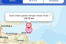
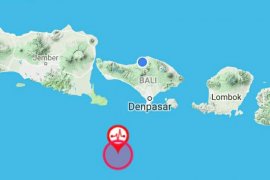
Bandarlampung (Antara Bali) - An earthquake measuring five on the Richter scale struck West Malang in East Java on Monday, according to the Meteorology, Climatology and Geophysics Agency (BMKG).
Head of BMKG Kotabumi at Lampung station Yuharman said the earthquake, which struck the district at 3:31 a.m. Western Indonesia Standard Time (WIB), did not have the potential to create a tsunami.
The quake was located at 10.56 degrees south latitude and 112.17 degrees east longitude, with a depth of 20 kilometres.
According to the BMKG, the earthquake occurred 265 kilometres southwest of Malang District, 269 kilometres southwest of Blitar District, 271 kilometres southeast of Tulungagung, 360 kilometres southwest of Surabaya, and 772 kilometres southeast of Jakarta.
Meanwhile, on September 1, 2013, an earthquake measuring 6.6 on the Richter scale hit northeast of Maluku Barat Daya (Southwest Maluku) and is believed to be 220 kilometres from the Maluku Barat Daya district.
According to the BMKG, the epicentre of the earthquake is 7.75 degrees south latitude and 128.4 degrees east longitude, with a depth of 131 kilometres. The quake had no potential to trigger a tsunami. (*/DWA)


