Although the Volcanology Center has reduced the danger zone around the crater to only a six-km radius, Mount Agung remains on its highest alert level IV.
The ministry`s written statement received by ANTARA in Jakarta, Thursday, noted that Mount Agung now remains in an eruption phase, with high and fluctuating volcanic activity.
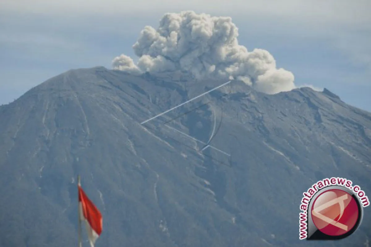
According to recent analysis on visual data and instrumental records, including seismic, deformation, and geochemical information, the volcano is still erupting and releasing lava, smoke, volcanic ash, and other molten particles from the crater.
The volume of lava inside the crater is currently some 20 million cubic meters, or one-third of the crater`s total volume of around 60 million cubic meters. The formation of the new dome at the top is relatively slow, and as a result, the lava may take a long time to completely fill the crater, the PVMBG explained.
The tremor status of Mount Agung until 6 p.m. local time on Wednesday (Dec 3) was relatively high, with deep and shallow frequencies indicating that the magma is still flowing from the chamber to the crater.
However, the intensity of the tremors has remained unchanged.
In the past few days, the deformation data has shown a stagnant trend, while the latest geochemical record has indicated that the amount of released magmatic sulfur dioxide flux was recorded at 100 tons per day.
The Volcanology Center has warned locals to remain vigilant mainly of hot stones, pebbles, and volcanic mudflow being spewed from the crater and affecting areas within a six-km radius from the peak.
Meanwhile, the volcanic mudflow may stream down the river situated at the volcano, depending on the flow of water and the volume of material ejected from the crater.
By observing the existing "intermittent" scale of the eruption, the risk of being burnt by the hot cloud is relatively low due to the slow lava activity inside the crater.
The authority explained that for the volcanic dome to deform into hot plumes, the volcano may need to produce high pressure within the chamber. However, up until today, the volcanic activity has remained stable without displaying any significant increase.
Hence, the PVMBG has renewed some of its instructions on Mount Agung`s safe and risky zones but still maintains the existing alert status at the highest level IV.
The authority has also called on all villagers and tourists to follow official instructions while remaining alert to any changes in Mount Agung`s volcanic activity. (WDY)
Pewarta: Reported by Afut SyafrilEditor : I Gusti Bagus Widyantara
COPYRIGHT © ANTARA 2026


